Article 10. Appendices
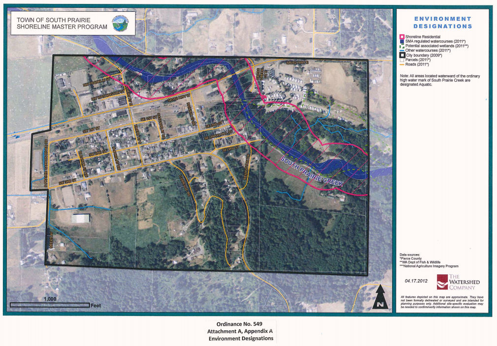
Appendix A. Shoreline buffer map and environment designation map
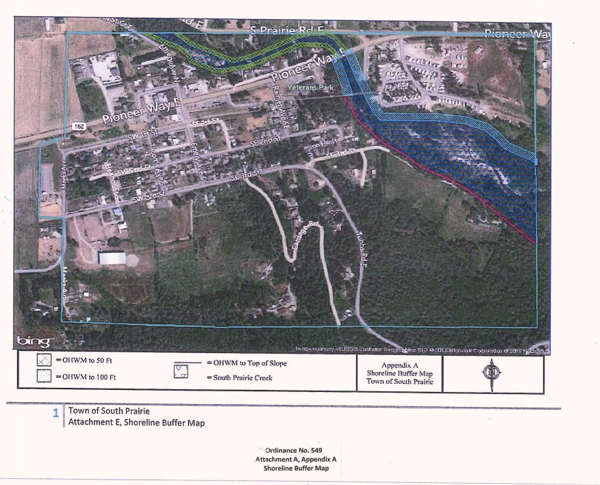
SHORELINE BUFFERS DESCRIPTION: The following description is intended to clarify the interpretation of the maps contained in Appendix A:
From the northern town limits extending to SR 162/Pioneer Way East, the shoreline buffer extends 50 feet from the OHWM on both stream banks of South Prairie Creek.
The shoreline buffer on the right bank* of South Prairie Creek from SR 162/Pioneer Way East to the eastern town limits is 100 feet from the OHWM.
The shoreline buffer on the left bank* of South Prairie Creek from SR 162/Pioneer Way East to the Foothills Trail is 100 feet from the OHWM.
The shoreline buffer from the Foothills Trail to the eastern town limits on the left bank* of South Prairie Creek is from the OHWM to the top of slope.
The environmental designation of all areas landwards of the OHWM is residential. The environmental designation for all areas waterward of the OHWM is aquatic.
*Left/right bank = left or right bank looking downstream.
[Res. 2023-04 § 1 (Att. B), 2023; Ord. 580 Att. A App. A, 2019.]